Geolocate

Kute Meriem topographic map

Click on the map to display elevation.

About this map

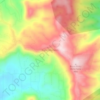
Name: Kute Meriem topographic map, elevation, terrain.

Location: Kute Meriem, Atu Lintang, Aceh Tengah, Aceh, Sumatra, Indonesia (4.44412 96.78444 4.48412 96.82444)

Average elevation: 1,693 m

Minimum elevation: 1,488 m

Maximum elevation: 1,885 m

Gear up for your next adventure:

🛶Canoe Life Vest - Safety vest for water sports
🥾Trail Hiking Socks - Comfortable socks to prevent blisters and fatigue
Backpacking Tent - Lightweight tent for long-distance hiking trips
🪑Ultralight Camping Stool - Compact seating for rest stops during long hikes
🧴Waterproofing Spray - Restore the DWR coating on jackets and tents

As an Amazon Associate, this site earns from qualifying purchases at no extra cost to you.