
Tortel topographic map
Interactive map
Click on the map to display elevation.
About this map
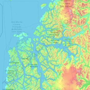
Name: Tortel topographic map, elevation, terrain.
Average elevation: 355 m
Minimum elevation: -2 m
Maximum elevation: 3,282 m
Other topographic maps
Click on a map to view its topography, its elevation and its terrain.
Caleta Tortel
Chili > Aisén du Général Carlos Ibáñez del Campo > Provincia de Capitán Prat > Tortel
Caleta Tortel, Tortel, Provincia de Capitán Prat, Aisén du Général Carlos Ibáñez del Campo, 6120000, Chili
Average elevation: 70 m