Geolocate

El Argumal topographic map

Click on the map to display elevation.

About this map

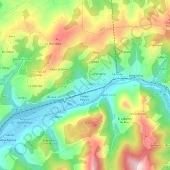
Name: El Argumal topographic map, elevation, terrain.

Location: El Argumal, Tudela Veguín, Oviedo, Asturias, 33919, España (43.31275 -5.79667 43.35275 -5.75667)

Average elevation: 328 m

Minimum elevation: 154 m

Maximum elevation: 576 m

Gear up for your next adventure:

🧦Crew Hiking Socks - Comfortable socks for long-distance hikes
🧢Sun Hat - Wide-brim hat for sun protection
🔥Camping Stove - Portable stoves to cook outdoors with ease
🛁Quick-Dry Microfiber Towel - Space-saving towel that dries rapidly on the move
🗺️Topographic Maps - Detailed maps to explore trails, mountains, and wilderness areas

As an Amazon Associate, this site earns from qualifying purchases at no extra cost to you.