Geolocate

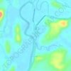
Capoocan topographic map

Click on the map to display elevation.

About this map

Name: Capoocan topographic map, elevation, terrain.

Location: Capoocan, Calbayog, Samar, Eastern Visayas, 6710, Philippines (12.04761 124.56796 12.08761 124.60796)

Average elevation: 6 m

Minimum elevation: -1 m

Maximum elevation: 47 m

Other topographic maps

Click on a map to view its topography, its elevation and its terrain.

Gear up for your next adventure:

⛺Lightweight Camping Tent - Portable shelter optimized for Canadian backcountry camping
🔦LED Headlamp - Hands-free lighting for early morning starts or late finishes
🐕Hiking Dog Pack - Let your canine companion carry their own water and food
🥾All-Terrain Hiking Boots - Versatile boots for varied hiking conditions
🕶️Polarized Sunglasses - Reduces glare from snow and water at high elevations

As an Amazon Associate, this site earns from qualifying purchases at no extra cost to you.