
Thank you for supporting this site ❤️
Make a donation
Make a donation
Gear up for your next adventure:
As an Amazon Associate, this site earns from qualifying purchases at no extra cost to you.
Rancamanyar topographic map
Click on the map to display elevation.
Thank you for supporting this site ❤️
Make a donation
Make a donation
Gear up for your next adventure:
As an Amazon Associate, this site earns from qualifying purchases at no extra cost to you.
About this map
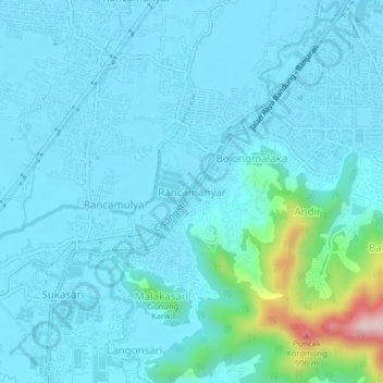
Name: Rancamanyar topographic map, elevation, terrain.
Location: Rancamanyar, Bandung, West Java, Java, 40376, Indonesia (-7.03260 107.58916 -6.99260 107.62916)
Average elevation: 699 m
Minimum elevation: 658 m
Maximum elevation: 1,020 m
Thank you for supporting this site ❤️
Make a donation
Make a donation
Gear up for your next adventure:
As an Amazon Associate, this site earns from qualifying purchases at no extra cost to you.