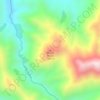
Severn River topographic map
Click on the map to display elevation.
About this map

Name: Severn River topographic map, elevation, terrain.
Average elevation: 1,329 m
Minimum elevation: 810 m
Maximum elevation: 2,115 m
Other topographic maps
Click on a map to view its topography, its elevation and its terrain.
Picton
New Zealand > Marlborough > Marlborough District
On the land side, Picton is surrounded by hills and mountains, including Te Tara-o-Te-Marama/Mount Freeth to the west, the Robertson Range to the south and Mount McCormick to the east. The Elevation Saddle connects southwest of the town with the Tuamarina River valley and contains the main land transport…
Average elevation: 193 m







Pelorus Sound
New Zealand > Marlborough > Marlborough District
A further factor affecting the hydrodynamics of Pelorus Sound is wind. Winds in the area are generally strong and are channelled by the steep topography. Wind stress acting on the surface generates currents, which have not been well described. The wind stress also generates turbulence, which causes the surface…
Average elevation: 144 m


Picton
New Zealand > Marlborough > Marlborough District
On the land side, Picton is surrounded by hills and mountains, including Te Tara-o-Te-Marama/Mount Freeth to the west, the Robertson Range to the south and Mount McCormick to the east. The Elevation Saddle connects southwest of the town with the Tuamarina River valley and contains the main land transport…
Average elevation: 193 m
Picton
New Zealand > Marlborough > Marlborough District
On the land side, Picton is surrounded by hills and mountains, including Te Tara-o-Te-Marama/Mount Freeth to the west, the Robertson Range to the south and Mount McCormick to the east. The Elevation Saddle connects southwest of the town with the Tuamarina River valley and contains the main land transport…
Average elevation: 193 m