Geolocate

Oberberg topographic map

Click on the map to display elevation.

About this map

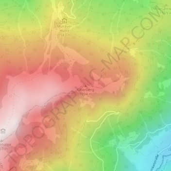
Name: Oberberg topographic map, elevation, terrain.

Location: Oberberg, Murau, Bezirk Murau, Styria, 8850, Austria (47.07328 14.15631 47.07338 14.15641)

Average elevation: 1,572 m

Minimum elevation: 1,052 m

Maximum elevation: 1,981 m

Gear up for your next adventure:

🛰️Satellite Messenger - Emergency communication for areas with no cell service
🧰Survival Kit - Essential gear for emergencies in the wilderness
🔦LED Headlamp - Hands-free lighting for early morning starts or late finishes
🧴Outdoor Sunscreen - High SPF protection for high-altitude UV exposure
🧢Sun Protection Cap - Breathable cap to protect from sun exposure

As an Amazon Associate, this site earns from qualifying purchases at no extra cost to you.