Geolocate

Belleville topographic map

Click on the map to display elevation.

About this map

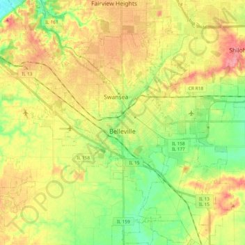
Name: Belleville topographic map, elevation, terrain.

Location: Belleville, Saint Clair County, Illinois, United States (38.44661 -90.08687 38.59082 -89.90517)

Average elevation: 163 m

Minimum elevation: 124 m

Maximum elevation: 205 m

Other topographic maps

Click on a map to view its topography, its elevation and its terrain.

Summit

United States > Illinois > Saint Clair County

Average elevation: 174 m

Gear up for your next adventure:

🧴Outdoor Sunscreen - High SPF protection for high-altitude UV exposure
🔪Outdoor Multitool - Versatile tool for repairs and food prep in the wild
💧Filtered Water Bottle - Safe drinking water on the go
🥾Trail Running Boots - Durable shoes designed for trail running
🥾Mountain Trail Shoes - High-traction shoes for mountain trails

As an Amazon Associate, this site earns from qualifying purchases at no extra cost to you.