Geolocate

Concepcion Dos topographic map

Click on the map to display elevation.

About this map
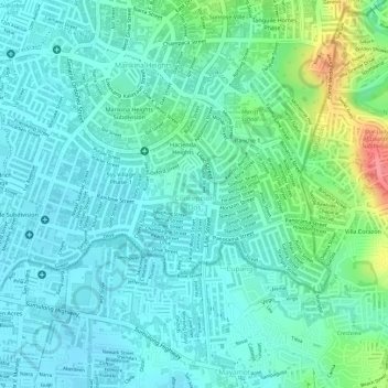
Name: Concepcion Dos topographic map, elevation, terrain.

Location: Concepcion Dos, District II, Marikina, Eastern Manila District, Metro Manila, 1811, Philippines (14.63433 121.10860 14.64800 121.13056)

Average elevation: 29 m

Minimum elevation: 8 m

Maximum elevation: 91 m

Other topographic maps

Click on a map to view its topography, its elevation and its terrain.
Marikina River Park

Philippines > Marikina

Average elevation: 14 m

Marikina Riverbanks

Philippines > Marikina

Average elevation: 26 m

flood prone

Philippines > Marikina

Average elevation: 27 m

Gear up for your next adventure:

💡Compact LED Flashlight - Powerful and portable flashlight for outdoor use
🧥Ultralight Puffy Jacket - Maximum warmth that packs down to the size of an orange
🌬️Windproof Camp Stove - Efficient cooking even on exposed mountain peaks
🧳Compression Sacks - Maximize space in your backpack by shrinking gear
🛌Insulated Sleeping Pad - Critical thermal barrier between you and the cold ground

As an Amazon Associate, this site earns from qualifying purchases at no extra cost to you.