
Thank you for supporting this site ❤️
Make a donation
Make a donation
Gear up for your next adventure:
As an Amazon Associate, this site earns from qualifying purchases at no extra cost to you.
Rāmgarh topographic map
Click on the map to display elevation.
Thank you for supporting this site ❤️
Make a donation
Make a donation
Gear up for your next adventure:
As an Amazon Associate, this site earns from qualifying purchases at no extra cost to you.
About this map
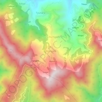
Name: Rāmgarh topographic map, elevation, terrain.
Location: Rāmgarh, Kosya Kutauli, Nainital, Uttarakhand, India (29.40233 79.53115 29.44233 79.57115)
Average elevation: 1,945 m
Minimum elevation: 1,483 m
Maximum elevation: 2,363 m
Thank you for supporting this site ❤️
Make a donation
Make a donation
Gear up for your next adventure:
As an Amazon Associate, this site earns from qualifying purchases at no extra cost to you.