
Gutau topographic map
Click on the map to display elevation.
About this map
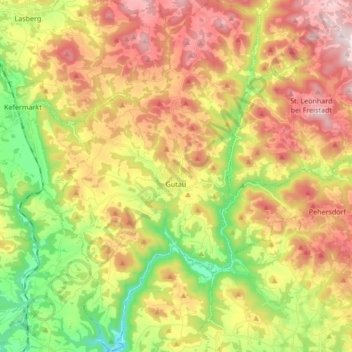
Name: Gutau topographic map, elevation, terrain.
Location: Gutau, Bezirk Freistadt, Upper Austria, 4293, Austria (48.36454 14.55374 48.47710 14.65294)
Average elevation: 618 m
Minimum elevation: 354 m
Maximum elevation: 899 m
Other topographic maps
Click on a map to view its topography, its elevation and its terrain.
Prandegg
Austria > Upper Austria > Bezirk Freistadt > Schönau im Mühlkreis > Prandegg
Average elevation: 627 m