Geolocate

San Ramon topographic map

Click on the map to display elevation.

About this map
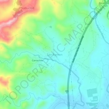
Name: San Ramon topographic map, elevation, terrain.

Location: San Ramon, Floridablanca, Pampanga, Central Luzon, Philippines (14.97955 120.43340 15.01955 120.47340)

Average elevation: 107 m

Minimum elevation: 33 m

Maximum elevation: 315 m

Other topographic maps

Click on a map to view its topography, its elevation and its terrain.

Anon

Philippines > Pampanga > Floridablanca

Average elevation: 16 m

Calantas

Philippines > Pampanga > Floridablanca

Average elevation: 50 m

Gear up for your next adventure:

🧦Merino Wool Socks - Moisture-wicking comfort for long-distance hiking
🧊Portable Cooler - Keep food and drinks cold during outdoor adventures
🧣Merino Neck Gaiter - Protects against wind, sun, and cold at high altitudes
🥾Waterproof Hiking Boots - Essential footwear for rugged terrain and wet Canadian trails
🧢Hiking Sun Hat - Wide-brimmed protection for exposed mountain ridges

As an Amazon Associate, this site earns from qualifying purchases at no extra cost to you.