Geolocate

Jorethang topographic map

Click on the map to display elevation.

About this map

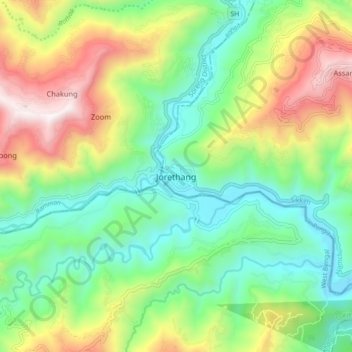
Name: Jorethang topographic map, elevation, terrain.

Location: Jorethang, Namchi, Sikkim, India (27.09152 88.24253 27.17152 88.32253)

Average elevation: 723 m

Minimum elevation: 268 m

Maximum elevation: 1,547 m

Other topographic maps

Click on a map to view its topography, its elevation and its terrain.

Central Park

India > Sikkim > Namchi > Namchi

Average elevation: 1,296 m

Gear up for your next adventure:

🛶Kayak Dry Bag - Waterproof storage for kayaking adventures
🧦Merino Wool Socks - Moisture-wicking comfort for long-distance hiking
🧢Sun Hat - Wide-brim hat for sun protection
💡Solar Camping Lamp - Eco-friendly lighting for campsites
🧭GPS Handheld Device - Reliable GPS navigation for outdoor adventures

As an Amazon Associate, this site earns from qualifying purchases at no extra cost to you.