Geolocate

Punta Cangrejo topographic map

Click on the map to display elevation.

About this map

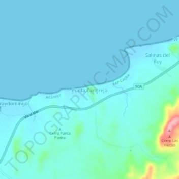
Name: Punta Cangrejo topographic map, elevation, terrain.

Location: Punta Cangrejo, Juan de Acosta, Atlántico, Colombia (10.84413 -75.12908 10.88413 -75.08908)

Average elevation: 15 m

Minimum elevation: -1 m

Maximum elevation: 138 m

Other topographic maps

Click on a map to view its topography, its elevation and its terrain.

Saco

Colombia > Atlántico > Juan de Acosta

Average elevation: 80 m

Saco

Colombia > Atlántico > Juan de Acosta

Average elevation: 80 m

Gear up for your next adventure:

🦟Insect Repellent - Keep mosquitoes and black flies away in wooded areas
🛁Quick-Dry Microfiber Towel - Space-saving towel that dries rapidly on the move
🥾Lightweight Hiking Shoes - Comfortable shoes for day hikes
🥾Hiking Shorts - Breathable shorts suitable for summer hikes
🧤Rechargeable Heated Gloves - Extreme warmth for Canadian winter expeditions

As an Amazon Associate, this site earns from qualifying purchases at no extra cost to you.