Geolocate

Kumbhirgram topographic map

Click on the map to display elevation.

About this map

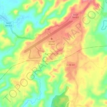
Name: Kumbhirgram topographic map, elevation, terrain.

Location: Kumbhirgram, Udarbond, Cachar, Assam, 788108, India (24.88693 92.96163 24.92693 93.00163)

Average elevation: 76 m

Minimum elevation: 30 m

Maximum elevation: 118 m

Gear up for your next adventure:

🦟Insect Repellent - Keep mosquitoes and black flies away in wooded areas
🧊Portable Cooler - Keep food and drinks cold during outdoor adventures
🧰Multitool Knife - Compact and versatile tool for outdoor use
Camping Coffee Maker - Brew fresh coffee anywhere on the topographic map
❄️Traction Ice Cleats - Slip-on spikes for icy trails and winter hiking

As an Amazon Associate, this site earns from qualifying purchases at no extra cost to you.