Geolocate

Piedras topographic map

Click on the map to display elevation.

About this map

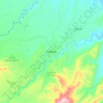
Name: Piedras topographic map, elevation, terrain.

Location: Piedras, Centro, Tolima, Colombia (4.50298 -74.91888 4.58298 -74.83888)

Average elevation: 415 m

Minimum elevation: 260 m

Maximum elevation: 845 m

Gear up for your next adventure:

🧢Hiking Hat - Sun-protective and breathable hats for long treks
🥾Light Hiking Boots - Lightweight and comfortable boots for day hikes
🧥Insulated Jacket - Keep warm in cold outdoor conditions
Lightweight Backpacking Tent - Compact tent for efficient hiking trips
🎒Hiking Daypack - Lightweight and durable backpacks for day trips and excursions

As an Amazon Associate, this site earns from qualifying purchases at no extra cost to you.