Geolocate

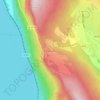
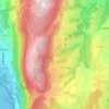
Lassy topographic map

Click on the map to display elevation.

About this map

Name: Lassy topographic map, elevation, terrain.

Location: Lassy, Saint-Germain-la-Chambotte, Entrelacs, Chambéry, Savoie, Auvergne-Rhône-Alpes, France métropolitaine, 73410, France (45.75849 5.86794 45.79849 5.90794)

Average elevation: 542 m

Minimum elevation: 214 m

Maximum elevation: 833 m

Other topographic maps

Click on a map to view its topography, its elevation and its terrain.
Albens

France > Auvergne-Rhône-Alpes > Savoie > Entrelacs

Average elevation: 451 m

La Chambotte

France > Auvergne-Rhône-Alpes > Savoie > Entrelacs

Average elevation: 494 m

Épersy

France > Auvergne-Rhône-Alpes > Savoie > Entrelacs

Average elevation: 472 m

73410

France > Auvergne-Rhône-Alpes > Savoie > Entrelacs

Average elevation: 473 m

Saint-Girod

France > Auvergne-Rhône-Alpes > Savoie > Entrelacs

Average elevation: 432 m

Cessens

France > Auvergne-Rhône-Alpes > Savoie > Entrelacs

Average elevation: 621 m

Gear up for your next adventure:

🦶Hiking Shoe Insoles - Added support for high arches and long days on feet
🧦Outdoor Socks - Durable socks designed for hiking and outdoor sports
🧦Thermal Socks - Warm socks for winter hiking or camping
🏕️Camping Hammock - Integrated protection for sleeping between trees
🥘Camping Cookware Set - Compact nesting pots and pans for trail cooking

As an Amazon Associate, this site earns from qualifying purchases at no extra cost to you.