Geolocate

Cayo Coco topographic map

Click on the map to display elevation.

About this map

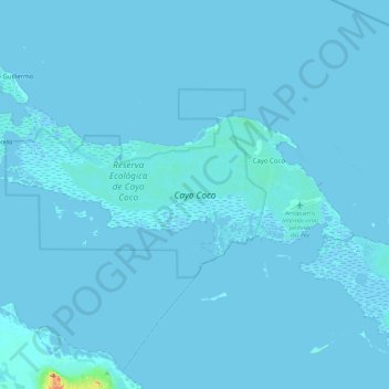
Name: Cayo Coco topographic map, elevation, terrain.

Location: Cayo Coco, Ciego de Avila, 69400, Cuba (22.37685 -78.71126 22.56713 -78.26956)

Average elevation: 1 m

Minimum elevation: -3 m

Maximum elevation: 88 m

Other topographic maps

Click on a map to view its topography, its elevation and its terrain.

Cayo Coco

Cuba > Ciego de Avila > Morón > Cayo Coco

Average elevation: 4 m

Gear up for your next adventure:

🥾Trail Hiking Shoes - Durable shoes designed for rugged trails
🔭Compact Binoculars - Lightweight optics for scouting trails and wildlife
🧥Waterproof Jacket - Lightweight rain jackets for hiking and outdoor activities
🧴First Aid Kit - Essential first aid supplies for outdoor emergencies
🧶550 Survival Paracord - Versatile utility cord for emergency repairs and rigging

As an Amazon Associate, this site earns from qualifying purchases at no extra cost to you.