
Thank you for supporting this site ❤️
Make a donation
Make a donation
Gear up for your next adventure:
As an Amazon Associate, this site earns from qualifying purchases at no extra cost to you.
Alderney topographic map
Click on the map to display elevation.
Thank you for supporting this site ❤️
Make a donation
Make a donation
Gear up for your next adventure:
As an Amazon Associate, this site earns from qualifying purchases at no extra cost to you.
About this map
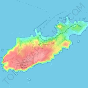
Name: Alderney topographic map, elevation, terrain.
Location: Alderney, Saint Anne, Alderney, GY9 3XT, Guernsey (49.70119 -2.23443 49.73283 -2.15908)
Average elevation: 13 m
Minimum elevation: 0 m
Maximum elevation: 88 m
Thank you for supporting this site ❤️
Make a donation
Make a donation
Gear up for your next adventure:
As an Amazon Associate, this site earns from qualifying purchases at no extra cost to you.