Geolocate

Waiatarua topographic map

Click on the map to display elevation.

About this map

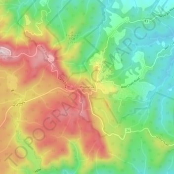
Name: Waiatarua topographic map, elevation, terrain.

Location: Waiatarua, Waitākere Ranges, Auckland, New Zealand (-36.95230 174.55816 -36.91230 174.59816)

Average elevation: 216 m

Minimum elevation: 49 m

Maximum elevation: 425 m

Other topographic maps

Click on a map to view its topography, its elevation and its terrain.

Mauku

New Zealand > Auckland > Waitākere Ranges

Average elevation: 86 m

Gear up for your next adventure:

💧Hydration Pack - Hands-free hydration system for long hikes
Camping Coffee Maker - Brew fresh coffee anywhere on the topographic map
🧼Travel Hand Sanitizer - Keep hands clean when water is scarce
🥾Trail Hiking Boots - Supportive boots for rough trails
🧰Multitool Knife - Compact and versatile tool for outdoor use

As an Amazon Associate, this site earns from qualifying purchases at no extra cost to you.