
បាត់ដំបង topographic map
Interactive map
Click on the map to display elevation.
About this map
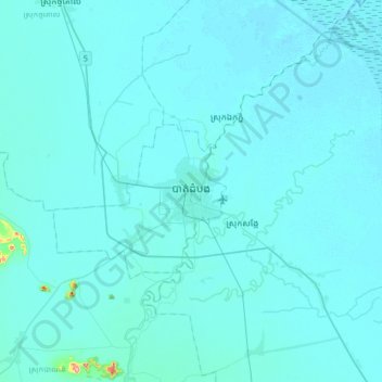
Name: បាត់ដំបង topographic map, elevation, terrain.
Location: បាត់ដំបង, Battambang, Cambodge (12.94203 103.03976 13.26203 103.35976)
Average elevation: 13 m
Minimum elevation: 6 m
Maximum elevation: 210 m
Other topographic maps
Click on a map to view its topography, its elevation and its terrain.