Geolocate

JKUAT Dam topographic map

Click on the map to display elevation.

About this map

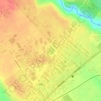
Name: JKUAT Dam topographic map, elevation, terrain.

Location: JKUAT Dam, Juja, Kiambu, Central Kenya, Kenya (-1.09377 37.01728 -1.09151 37.01962)

Average elevation: 1,519 m

Minimum elevation: 1,478 m

Maximum elevation: 1,537 m

Gear up for your next adventure:

🥾Mountain Hiking Shoes - Shoes with superior grip for mountainous terrain
🐕Hiking Dog Pack - Let your canine companion carry their own water and food
👟Sport Hiking Sandals - Breathable footwear for water crossings and camp rest
🧦Outdoor Socks - Durable socks designed for hiking and outdoor sports
🧊Portable Cooler - Keep food and drinks cold during outdoor adventures

As an Amazon Associate, this site earns from qualifying purchases at no extra cost to you.