Geolocate

Weichang topographic map

Click on the map to display elevation.

About this map

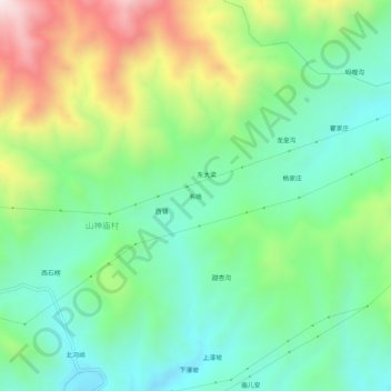
Name: Weichang topographic map, elevation, terrain.

Location: Weichang, Yi County, Baoding City, Hebei, China (39.48431 115.10599 39.52431 115.14599)

Average elevation: 933 m

Minimum elevation: 688 m

Maximum elevation: 1,430 m

Gear up for your next adventure:

🧴Bear Spray Holster - Quick-access carry for essential Canadian wilderness safety
🧣Merino Neck Gaiter - Protects against wind, sun, and cold at high altitudes
🧦Outdoor Socks - Durable socks designed for hiking and outdoor sports
🗺️Topographic Maps - Detailed maps to explore trails, mountains, and wilderness areas
🥾Approach Boots - Comfortable boots for hiking and climbing approaches

As an Amazon Associate, this site earns from qualifying purchases at no extra cost to you.