Geolocate

Lantik topographic map

Click on the map to display elevation.

About this map

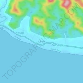
Name: Lantik topographic map, elevation, terrain.

Location: Lantik, Teupah Barat, Simeulue, Aceh, Sumatra, Indonesia (2.41510 96.23990 2.45510 96.27990)

Average elevation: 25 m

Minimum elevation: 0 m

Maximum elevation: 197 m

Gear up for your next adventure:

🌬️Windproof Camp Stove - Efficient cooking even on exposed mountain peaks
🥤Collapsible Travel Cup - Saves space and weight in your mess kit
🧥Waterproof Jacket - Lightweight rain jackets for hiking and outdoor activities
🧰Emergency Multi-Tool - Compact multi-tool for outdoor survival
Tent Footprint - Protect tent floor and increase durability

As an Amazon Associate, this site earns from qualifying purchases at no extra cost to you.