
Make a donation
Gear up for your next adventure:
As an Amazon Associate, this site earns from qualifying purchases at no extra cost to you.
Araria topographic map
Click on the map to display elevation.
Make a donation
Gear up for your next adventure:
As an Amazon Associate, this site earns from qualifying purchases at no extra cost to you.
Araria
Araria is located at 26°09′N 87°31′E / 26.15°N 87.52°E / 26.15; 87.52.[7] It has an average elevation of 47 metres (154 feet). Araria is situated at the northern part of Purnia and Madhepura in Bihar. Borders of Araria are surrounded by Nepal on the northern side, Kishanganj on the eastern side and Supaul on the south-west side. The district came into existence by the division of Purnia district on Makar Sankranti day of 1990. The district touches the Indo-Nepal international border also this area is very close to three countries: Nepal, Bangladesh, and Bhutan. Hence, the district is important in terms of security. Jogbani is the last point of Araria and after that, Morang district of Nepal starts.
Make a donation
Gear up for your next adventure:
As an Amazon Associate, this site earns from qualifying purchases at no extra cost to you.
About this map
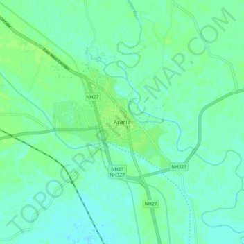
Name: Araria topographic map, elevation, terrain.
Location: Araria, Bihar, 854311, India (26.09465 87.42541 26.17465 87.50541)
Average elevation: 50 m
Minimum elevation: 46 m
Maximum elevation: 55 m
Make a donation
Gear up for your next adventure:
As an Amazon Associate, this site earns from qualifying purchases at no extra cost to you.