Geolocate

Hamtramck topographic map

Click on the map to display elevation.

About this map

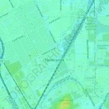
Name: Hamtramck topographic map, elevation, terrain.

Location: Hamtramck, Wayne County, Michigan, 48212, United States (42.37960 -83.07630 42.40899 -83.04063)

Average elevation: 193 m

Minimum elevation: 188 m

Maximum elevation: 202 m

Other topographic maps

Click on a map to view its topography, its elevation and its terrain.

Perrinville

United States > Michigan > Wayne County > Westland

Average elevation: 195 m

Sunnyside

United States > Michigan > Wayne County > Romulus

Average elevation: 194 m

Calvert Park

United States > Michigan > Wayne County > Detroit

Average elevation: 196 m

Elm

United States > Michigan > Wayne County > Livonia

Average elevation: 195 m

Newburg

United States > Michigan > Wayne County > Livonia

Average elevation: 209 m

Dearborn

United States > Michigan > Wayne County > Dearborn

Average elevation: 190 m

Gear up for your next adventure:

🛶Waterproof Dry Bags - Keep electronics and clothes dry during river crossings
🥾Approach Shoes - Shoes designed for climbing approaches and rugged trails
🥾Mountain Trail Shoes - High-traction shoes for mountain trails
🔭Compact Binoculars - Lightweight optics for scouting trails and wildlife
Camping Coffee Maker - Brew fresh coffee anywhere on the topographic map

As an Amazon Associate, this site earns from qualifying purchases at no extra cost to you.