Geolocate

Margudgued topographic map

Click on the map to display elevation.

About this map

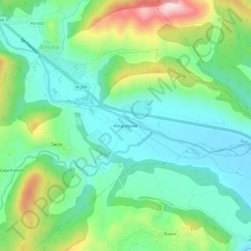
Name: Margudgued topographic map, elevation, terrain.

Location: Margudgued, Boltaña, Sobrarbe, Huesca, Aragón, 22340, España (42.41321 0.06452 42.45321 0.10452)

Average elevation: 670 m

Minimum elevation: 552 m

Maximum elevation: 954 m

Gear up for your next adventure:

🥾Waterproof Hiking Shoes - Durable shoes for wet and rugged trails
💡Compact LED Flashlight - Powerful and portable flashlight for outdoor use
🔥Camping Stove - Portable stoves to cook outdoors with ease
💧Filtered Water Bottle - Safe drinking water on the go
🧥Thermal Fleece Jacket - Versatile insulation for changing mountain temperatures

As an Amazon Associate, this site earns from qualifying purchases at no extra cost to you.