
Belleview Acres topographic map
Click on the map to display elevation.
About this map
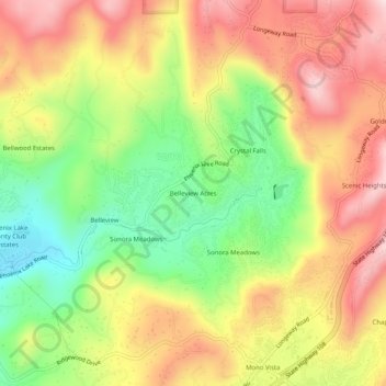
Name: Belleview Acres topographic map, elevation, terrain.
Average elevation: 905 m
Minimum elevation: 739 m
Maximum elevation: 1,061 m
Other topographic maps
Click on a map to view its topography, its elevation and its terrain.
Sonora
United States > California > Tuolumne County
Sonora is located at 37°59′04″N 120°22′54″W / 37.984361°N 120.381767°W / 37.984361; -120.381767, around the intersection of California State Highways 49 and 108 The altitude is 1,825 feet (556 m). According to the United States Census Bureau, the city has a total area of 3.1 square miles…
Average elevation: 615 m
Twain Harte
United States > California > Tuolumne County
Twain Harte is situated in Tuolumne County along Highway 108 at an elevation of 3,640 feet (1,110 m).
Average elevation: 1,123 m
Groveland-Big Oak Flat
United States > California > Tuolumne County > Groveland
Groveland-Big Oak Flat is located at 37°50′45″N 120°12′28″W / 37.845867°N 120.207697°W / 37.845867; -120.207697. Elevation is 867 m (2,846 ft).
Average elevation: 809 m
Sonora
United States > California > Tuolumne County
Sonora is located around the intersection of California State Highways 49 and 108 The altitude is 1,825 feet (556 m). According to the United States Census Bureau, the city covers a total area of 3.2 square miles (8.3 km2), making it the county's largest community by land area. 99.57% of the area is land and…
Average elevation: 614 m
Tuolumne Meadows
United States > California > Tuolumne County > Tuolumne Meadows
Average elevation: 2,668 m
Sonora
United States > California > Tuolumne County
Sonora is located at 37°59′04″N 120°22′54″W / 37.984361°N 120.381767°W / 37.984361; -120.381767, around the intersection of California State Highways 49 and 108 The altitude is 1,825 feet (556 m). According to the United States Census Bureau, the city has a total area of 3.1 square miles…
Average elevation: 615 m