Geolocate

Indianola topographic map

Click on the map to display elevation.

About this map

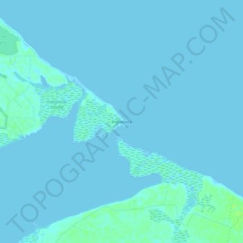
Name: Indianola topographic map, elevation, terrain.

Location: Indianola, Calhoun County, Texas, United States (28.49194 -96.50748 28.53194 -96.46748)

Average elevation: 1 m

Minimum elevation: -2 m

Maximum elevation: 10 m

Other topographic maps

Click on a map to view its topography, its elevation and its terrain.

Port Lavaca

United States > Texas > Calhoun County

Average elevation: 4 m

Seadrift

United States > Texas > Calhoun County

Average elevation: 3 m

Point Comfort

United States > Texas > Calhoun County

Average elevation: 7 m

Seadrift

United States > Texas > Calhoun County

Average elevation: 3 m

Gear up for your next adventure:

🧢Hiking Sun Hat - Wide-brimmed protection for exposed mountain ridges
🥾Waterproof Trail Shoes - Shoes designed to handle wet terrain
Lightweight Camping Tent - Portable shelter optimized for Canadian backcountry camping
Family Camping Tent - Spacious tent suitable for family camping trips
🧥Softshell Jacket - Windproof and breathable jacket for hiking

As an Amazon Associate, this site earns from qualifying purchases at no extra cost to you.