Geolocate

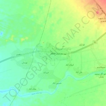
Bampur topographic map

Click on the map to display elevation.

Bampur

It is located 330 miles (530 km) south-east of Kerman at an elevation of 1,720 feet (520 m) In 1911 its population was about 2,000 and it was the capital of the province. It is situated on the banks of the Bampur river which flows from east to west and empties itself about 70 miles (110 km) west into a hamun, or depression, 50 miles (80 km) in length, and called Jaz Murian.

Wikipedia (CC-BY-SA 3.0)

About this map

Name: Bampur topographic map, elevation, terrain.

Location: Bampur, دهستان خیرآباد, بخش مرکزی شهرستان بمپور, Bampour County, Sistan and Baluchestan Province, Iran (27.15418 60.41548 27.23418 60.49548)

Average elevation: 516 m

Minimum elevation: 496 m

Maximum elevation: 553 m

Gear up for your next adventure:

🥘Camping Cookware Set - Compact nesting pots and pans for trail cooking
🧼Biodegradable Camp Soap - Environmentally friendly cleaning for gear and body
💡LED Headlamp - Hands-free illumination for night hiking and camping
🦌Outdoor Trail Camera - Monitor wildlife activity near your favorite spots
💡Portable Camping Lamp - Rechargeable lamp for campsite lighting

As an Amazon Associate, this site earns from qualifying purchases at no extra cost to you.