
Las Tahonas topographic map
Interactive map
Click on the map to display elevation.
About this map
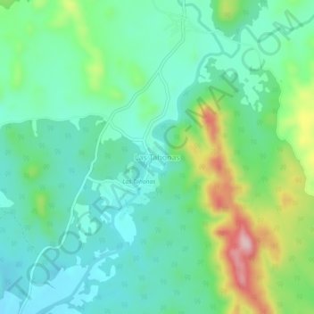
Name: Las Tahonas topographic map, elevation, terrain.
Location: Las Tahonas, Mocorito, Sinaloa, México (25.52965 -107.89392 25.56965 -107.85392)
Average elevation: 187 m
Minimum elevation: 116 m
Maximum elevation: 373 m