Geolocate

Sidi Saada topographic map

Click on the map to display elevation.

About this map
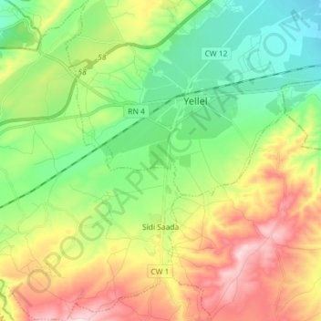
Name: Sidi Saada topographic map, elevation, terrain.

Location: Sidi Saada, Yellel District, Relizane, 48000, Algeria (35.64170 0.22720 35.75840 0.35080)

Average elevation: 199 m

Minimum elevation: 73 m

Maximum elevation: 400 m

Gear up for your next adventure:

🕶️Polarized Sunglasses - Protect your eyes with durable polarized lenses
🧥Waterproof Pants - Keep dry during rainy hiking conditions
🧦Crew Hiking Socks - Comfortable socks for long-distance hikes
🧰Multitool Knife - Compact and versatile tool for outdoor use
🏃Hydration Running Vest - Carry water and maps close to your body for speed

As an Amazon Associate, this site earns from qualifying purchases at no extra cost to you.