Geolocate

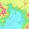
Karulai topographic map

Click on the map to display elevation.

About this map

Name: Karulai topographic map, elevation, terrain.

Location: Karulai, Nilambur, Malappuram, Kerala, 679330, India (11.27050 76.28142 11.31050 76.32142)

Average elevation: 42 m

Minimum elevation: 21 m

Maximum elevation: 100 m

Other topographic maps

Click on a map to view its topography, its elevation and its terrain.

Munderi

India > Kerala > Nilambur

Average elevation: 459 m

Muthukadu

India > Kerala > Nilambur > Nilambur

Average elevation: 36 m

Nilamboor

India > Kerala > Nilambur

Average elevation: 551 m

Gear up for your next adventure:

⛺Family Camping Tent - Spacious tent suitable for family camping trips
🚲Bike Repair Kit - Essential tools for on-trail mechanical issues
🧭Orienteering Kit - Tools for map reading and navigation in the wild
🥾All-Terrain Hiking Boots - Versatile boots for varied hiking conditions
🧭GPS Outdoor Watch - Smart watch for navigation and fitness tracking in nature

As an Amazon Associate, this site earns from qualifying purchases at no extra cost to you.