Geolocate

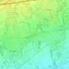
Gessate topographic map

Click on the map to display elevation.

About this map

Name: Gessate topographic map, elevation, terrain.

Location: Gessate, Milano, Lombardia, Italia (45.53970 9.40625 45.57546 9.45530)

Average elevation: 148 m

Minimum elevation: 130 m

Maximum elevation: 168 m

Other topographic maps

Click on a map to view its topography, its elevation and its terrain.
San Pietro all'Olmo

Italia > Lombardia > Milano > Cornaredo

Average elevation: 142 m

Milano 3

Italia > Lombardia > Milano

Average elevation: 100 m

Molino Ortolina

Italia > Lombardia > Milano > Pioltello

Average elevation: 123 m

Malvaglio

Italia > Lombardia > Milano > Robecchetto con Induno

Average elevation: 160 m

Monluè

Italia > Lombardia > Milano > Milano

Average elevation: 112 m

Cascina Villa

Italia > Lombardia > Milano > Lainate

Average elevation: 166 m

Gear up for your next adventure:

🪑Insulated Seat Pad - Protect your seat from cold rocks and wet logs
🧦Outdoor Socks - Durable socks designed for hiking and outdoor sports
🧴Insect Repellent - Protect yourself from bugs during outdoor adventures
⛺Camping Tent - Weather-resistant tents suitable for 2 to 6 people
🕶️Polarized Sunglasses - Reduces glare from snow and water at high elevations

As an Amazon Associate, this site earns from qualifying purchases at no extra cost to you.