Geolocate

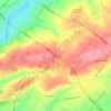
Evansburg topographic map

Click on the map to display elevation.

About this map

Name: Evansburg topographic map, elevation, terrain.

Location: Evansburg, Lower Providence Township, Montgomery County, Pennsylvania, United States (40.17593 -75.44670 40.20296 -75.41896)

Average elevation: 58 m

Minimum elevation: 31 m

Maximum elevation: 85 m

Other topographic maps

Click on a map to view its topography, its elevation and its terrain.
Gear up for your next adventure:

🔥Camping Stove - Portable stoves to cook outdoors with ease
🔪Outdoor Multitool - Versatile tool for repairs and food prep in the wild
🧥Softshell Hiking Jacket - The perfect balance of wind protection and breathability
🧴Waterproofing Spray - Restore the DWR coating on jackets and tents
🥾Trail Hiking Shoes - Durable shoes designed for rugged trails

As an Amazon Associate, this site earns from qualifying purchases at no extra cost to you.