Geolocate

A Lagoa topographic map

Click on the map to display elevation.

About this map

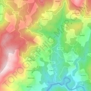
Name: A Lagoa topographic map, elevation, terrain.

Location: A Lagoa, Campo Lameiro, Pontevedra, Galicia, 36110, España (42.52017 -8.56398 42.56017 -8.52398)

Average elevation: 285 m

Minimum elevation: 63 m

Maximum elevation: 534 m

Gear up for your next adventure:

🥾Trail Running Boots - Durable shoes designed for trail running
🥽Outdoor Goggles - Protective eyewear for outdoor activities
🦟Insect Repellent - Keep mosquitoes and black flies away in wooded areas
🥾Mountain Hiking Shoes - Shoes with superior grip for mountainous terrain
👖Convertible Hiking Pants - Zip-off legs to adapt to changing weather conditions

As an Amazon Associate, this site earns from qualifying purchases at no extra cost to you.