
Thank you for supporting this site ❤️
Make a donation
Make a donation
Gear up for your next adventure:
As an Amazon Associate, this site earns from qualifying purchases at no extra cost to you.
Ceseggi topographic map
Click on the map to display elevation.
Thank you for supporting this site ❤️
Make a donation
Make a donation
Gear up for your next adventure:
As an Amazon Associate, this site earns from qualifying purchases at no extra cost to you.
About this map
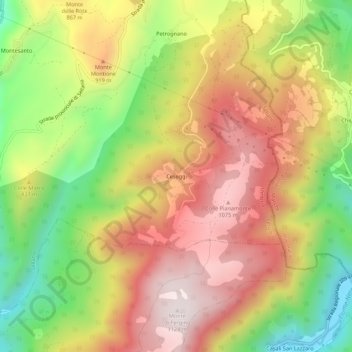
Name: Ceseggi topographic map, elevation, terrain.
Location: Ceseggi, Sellano, Perugia, Umbria, 06030, Italia (42.86010 12.93913 42.90010 12.97913)
Average elevation: 800 m
Minimum elevation: 436 m
Maximum elevation: 1,121 m
Thank you for supporting this site ❤️
Make a donation
Make a donation
Gear up for your next adventure:
As an Amazon Associate, this site earns from qualifying purchases at no extra cost to you.