Geolocate

Almargen topographic map

Click on the map to display elevation.

About this map

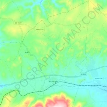
Name: Almargen topographic map, elevation, terrain.

Location: Almargen, Guadalteba, Malaga, Andalusia, 29330, Spain (36.98295 -5.05576 37.06458 -4.98829)

Average elevation: 558 m

Minimum elevation: 450 m

Maximum elevation: 837 m

Gear up for your next adventure:

💧Collapsible Water Bottle - Space-saving water bottle for outdoor activities
Tent Footprint - Protect tent floor and increase durability
Camping Coffee Maker - Brew fresh coffee anywhere on the topographic map
🥾Hiking Leggings - Comfortable leggings for outdoor activities
🧰Emergency Multi-Tool - Compact multi-tool for outdoor survival

As an Amazon Associate, this site earns from qualifying purchases at no extra cost to you.