Geolocate

Guasa topographic map

Click on the map to display elevation.

About this map

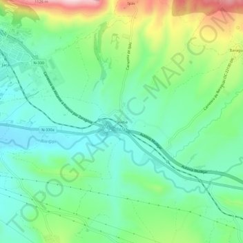
Name: Guasa topographic map, elevation, terrain.

Location: Guasa, Jaca, La Jacetania, Huesca, Aragón, 22712, España (42.54743 -0.53247 42.58743 -0.49247)

Average elevation: 881 m

Minimum elevation: 790 m

Maximum elevation: 1,090 m

Other topographic maps

Click on a map to view its topography, its elevation and its terrain.

Ibon de Astun (Truchas)

España > Aragón > La Jacetania > Jaca

Average elevation: 2,048 m

Gear up for your next adventure:

💡LED Headlamp - Hands-free illumination for night hiking and camping
🧭GPS Tracker - Track your location in remote areas safely
🧣Merino Neck Gaiter - Protects against wind, sun, and cold at high altitudes
🧴Outdoor Sunscreen - High SPF protection for high-altitude UV exposure
🔭Compact Binoculars - Lightweight optics for scouting trails and wildlife

As an Amazon Associate, this site earns from qualifying purchases at no extra cost to you.