Geolocate

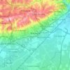
Birtouta topographic map

Click on the map to display elevation.

About this map

Name: Birtouta topographic map, elevation, terrain.

Location: Birtouta, Birtouta District, Algiers, 16000, Algeria (36.60499 2.95855 36.68499 3.03855)

Average elevation: 81 m

Minimum elevation: 20 m

Maximum elevation: 227 m

Other topographic maps

Click on a map to view its topography, its elevation and its terrain.

Ouled Chebel

Algeria > Algiers > Birtouta District

Average elevation: 47 m

Birtouta

Algeria > Algiers > Birtouta District

Average elevation: 78 m

Gear up for your next adventure:

🔦LED Flashlight - Powerful and long-lasting flashlight for camping and emergencies
🧥Waterproof Jacket - Lightweight rain jackets for hiking and outdoor activities
🥾Waterproof Trail Shoes - Shoes designed to handle wet terrain
💡LED Headlamp - Hands-free illumination for night hiking and camping
🧭Orienteering Kit - Tools for map reading and navigation in the wild

As an Amazon Associate, this site earns from qualifying purchases at no extra cost to you.