
Thank you for supporting this site ❤️
Make a donation
Make a donation
Gear up for your next adventure:
As an Amazon Associate, this site earns from qualifying purchases at no extra cost to you.
Baekto-ri topographic map
Click on the map to display elevation.
Thank you for supporting this site ❤️
Make a donation
Make a donation
Gear up for your next adventure:
As an Amazon Associate, this site earns from qualifying purchases at no extra cost to you.
About this map
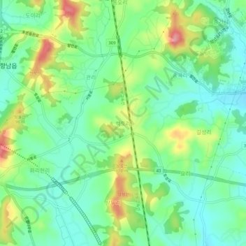
Name: Baekto-ri topographic map, elevation, terrain.
Location: Baekto-ri, Hwaseong-si, Gyeonggi, 18589, South Korea (37.09995 126.93590 37.13995 126.97590)
Average elevation: 58 m
Minimum elevation: 16 m
Maximum elevation: 140 m
Thank you for supporting this site ❤️
Make a donation
Make a donation
Gear up for your next adventure:
As an Amazon Associate, this site earns from qualifying purchases at no extra cost to you.