Geolocate

San Pedro topographic map

Click on the map to display elevation.

About this map
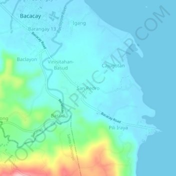
Name: San Pedro topographic map, elevation, terrain.

Location: San Pedro, Bacacay, Albay, Bicol Region, 4509, Philippines (13.25616 123.78473 13.29616 123.82473)

Average elevation: 24 m

Minimum elevation: -2 m

Maximum elevation: 154 m

Other topographic maps

Click on a map to view its topography, its elevation and its terrain.

Pinamuntugan Island

Philippines > Albay > Bacacay > Busdac

Average elevation: 8 m

Sula Island

Philippines > Albay > Bacacay > Nahapunan

Average elevation: 13 m

Pinamuntugan Island

Philippines > Albay > Bacacay > Busdac

Average elevation: 8 m

Gear up for your next adventure:

🧥Fleece Jacket - Warm and lightweight jacket for layering
🔋Solar Power Bank - Keep your GPS and devices charged during long outdoor trips
🪜Heavy Duty Carabiners - Multi-use clips for securing gear to your backpack
🥾Hiking Boots - Sturdy boots providing ankle support and traction on rugged trails
🥾Light Trekking Boots - Supportive boots for multi-day treks

As an Amazon Associate, this site earns from qualifying purchases at no extra cost to you.