Geolocate

Marine topographic map

Click on the map to display elevation.

About this map

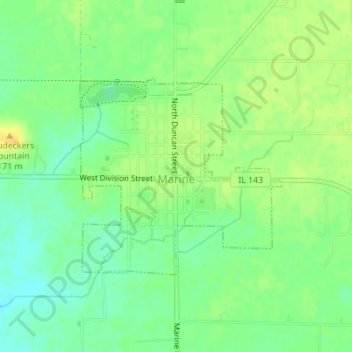
Name: Marine topographic map, elevation, terrain.

Location: Marine, Madison County, Illinois, 62061, United States (38.77911 -89.78708 38.79418 -89.76722)

Average elevation: 158 m

Minimum elevation: 145 m

Maximum elevation: 172 m

Other topographic maps

Click on a map to view its topography, its elevation and its terrain.

North Venice

United States > Illinois > Madison County > Venice

Average elevation: 126 m

North Alton

United States > Illinois > Madison County > Godfrey

Average elevation: 179 m

Bethalto

United States > Illinois > Madison County > Bethalto > Bethalto

Average elevation: 156 m

Alton

United States > Illinois > Madison County > Alton

Average elevation: 147 m

Gear up for your next adventure:

🧦Thermal Socks - Warm socks for winter hiking or camping
Lightweight Camping Tent - Portable shelter optimized for Canadian backcountry camping
👟Sport Hiking Sandals - Breathable footwear for water crossings and camp rest
🪑Insulated Seat Pad - Protect your seat from cold rocks and wet logs
🕶️Polarized Sunglasses - Reduces glare from snow and water at high elevations

As an Amazon Associate, this site earns from qualifying purchases at no extra cost to you.