Geolocate

Chetaibi topographic map

Click on the map to display elevation.

About this map
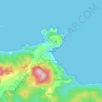
Name: Chetaibi topographic map, elevation, terrain.

Location: Chetaibi, Chetaibi District, Annaba, 23014, Algeria (37.02504 7.33998 37.10504 7.41998)

Average elevation: 78 m

Minimum elevation: 0 m

Maximum elevation: 541 m

Gear up for your next adventure:

🐕Hiking Dog Pack - Let your canine companion carry their own water and food
🥾Hiking Gaiters - Protect legs and shoes from mud, snow, and debris
🛶Kayak Accessories - Essential gear for safe and fun kayaking adventures
🧴Waterproofing Spray - Restore the DWR coating on jackets and tents
🛶Waterproof Dry Bags - Keep electronics and clothes dry during river crossings

As an Amazon Associate, this site earns from qualifying purchases at no extra cost to you.