Geolocate

Hettoli topographic map

Click on the map to display elevation.

About this map
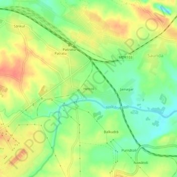
Name: Hettoli topographic map, elevation, terrain.

Location: Hettoli, Saunda, Patratu, Ramgarh, Jharkhand, 829118, India (23.63701 85.29050 23.67701 85.33050)

Average elevation: 368 m

Minimum elevation: 343 m

Maximum elevation: 392 m

Gear up for your next adventure:

🥾Light Hiking Boots - Lightweight and comfortable boots for day hikes
🍽️Titanium Camping Spork - Ultralight and indestructible eating utensil
🔨Vehicle Emergency Tool - Safety tool for remote road trips to trailheads
🥾Trail Hiking Socks - Comfortable socks to prevent blisters and fatigue
⛺Bushcraft Tarp - Versatile emergency shelter or gear protection

As an Amazon Associate, this site earns from qualifying purchases at no extra cost to you.