Geolocate

Ichemoul topographic map

Click on the map to display elevation.

About this map
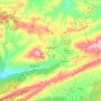
Name: Ichemoul topographic map, elevation, terrain.

Location: Ichemoul, Ichemoul district, Batna, 05000, Algeria (35.24195 6.37968 35.36782 6.59497)

Average elevation: 1,559 m

Minimum elevation: 1,144 m

Maximum elevation: 2,142 m

Gear up for your next adventure:

🥾Waterproof Trail Shoes - Shoes designed to handle wet terrain
⛺Bushcraft Tarp - Versatile emergency shelter or gear protection
🏕️Camping Hammock - Integrated protection for sleeping between trees
🧦Hiking Socks - Moisture-wicking and comfortable socks for long hikes
🔭Compact Monocular - One-handed bird watching and trail spotting

As an Amazon Associate, this site earns from qualifying purchases at no extra cost to you.