Geolocate

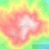
Cobb topographic map

Click on the map to display elevation.

Cobb

Cobb is a census designated place (CDP) in Lake County, California, United States. Cobb is located 1 mile (1.6 km) northwest of Whispering Pines, at an elevation of 2,631 feet (802 m). The population was 1,295 at the 2020 census, down from 1,778 at the 2010 census.

Wikipedia (CC-BY-SA 3.0)

About this map

Name: Cobb topographic map, elevation, terrain.

Location: Cobb, Lake County, California, 95426, United States (38.80786 -122.76001 38.85842 -122.68102)

Average elevation: 920 m

Minimum elevation: 547 m

Maximum elevation: 1,438 m

Other topographic maps

Click on a map to view its topography, its elevation and its terrain.
Whispering Pines

United States > California > Lake County > Cobb

Average elevation: 925 m

Cobb Mountain

United States > California > Lake County > Cobb

Average elevation: 1,192 m

Gear up for your next adventure:

👖Convertible Hiking Pants - Zip-off legs to adapt to changing weather conditions
🚑Survival Whistle - Signal for help across long distances in mountains
🧢Outdoor Visor - Breathable visor for sunny hikes
🚲Handlebar Phone Mount - View topographic-map.com live while cycling
🧭GPS Tracker - Track your location in remote areas safely

As an Amazon Associate, this site earns from qualifying purchases at no extra cost to you.