Geolocate

Keeken topographic map

Click on the map to display elevation.

About this map
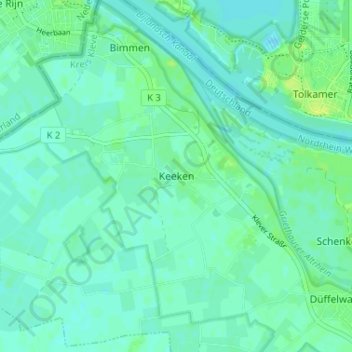
Name: Keeken topographic map, elevation, terrain.

Location: Keeken, Cleves, Bedburg-Hau, Kreis Kleve, North Rhine-Westphalia, 47533, Germany (51.82382 6.05708 51.86382 6.09708)

Average elevation: 13 m

Minimum elevation: 8 m

Maximum elevation: 21 m

Other topographic maps

Click on a map to view its topography, its elevation and its terrain.
47533

Germany > North Rhine-Westphalia > Kreis Kleve > Cleves

Average elevation: 24 m

Gear up for your next adventure:

🎒Hiking Backpack - Lightweight and ergonomic backpacks for day hikes or multi-day treks
🚲Bike Repair Kit - Essential tools for on-trail mechanical issues
🧳Compression Sacks - Maximize space in your backpack by shrinking gear
🥾Trekking Poles - Adjustable trekking poles to reduce knee stress and improve stability
🧥Softshell Hiking Jacket - The perfect balance of wind protection and breathability

As an Amazon Associate, this site earns from qualifying purchases at no extra cost to you.