Geolocate

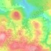
22810 topographic map

Click on the map to display elevation.

About this map

Name: 22810 topographic map, elevation, terrain.

Location: 22810, Les Forges, Belle-Isle-en-Terre, Guingamp, Côtes-d'Armor, Bretagne, France métropolitaine, France (48.45612 -3.50733 48.58351 -3.32006)

Average elevation: 194 m

Minimum elevation: 63 m

Maximum elevation: 319 m

Other topographic maps

Click on a map to view its topography, its elevation and its terrain.

Gear up for your next adventure:

🦌Outdoor Trail Camera - Monitor wildlife activity near your favorite spots
🛶Kayak Dry Bag - Waterproof storage for kayaking adventures
🚲Bike Repair Kit - Essential tools for on-trail mechanical issues
🧦Hiking Liner Socks - Thin base layer to prevent friction and blisters
🔦LED Headtorch - Bright and durable light for night activities

As an Amazon Associate, this site earns from qualifying purchases at no extra cost to you.