
Gryfice topographic map
Interactive map
Click on the map to display elevation.
About this map
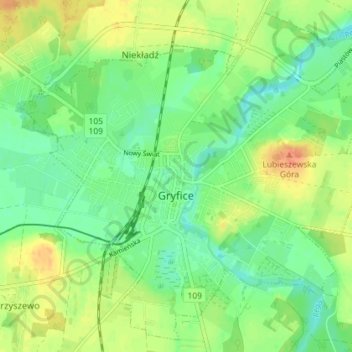
Name: Gryfice topographic map, elevation, terrain.
Average elevation: 24 m
Minimum elevation: 8 m
Maximum elevation: 46 m
Other topographic maps
Click on a map to view its topography, its elevation and its terrain.
Wicimice
Poland > West Pomeranian Voivodeship > Gryfice County
Wicimice, gmina Płoty, Gryfice County, West Pomeranian Voivodeship, 72-311, Poland
Average elevation: 45 m
Trzebiatów
Poland > West Pomeranian Voivodeship > Gryfice County
Trzebiatów, gmina Trzebiatów, Gryfice County, West Pomeranian Voivodeship, Poland
Average elevation: 11 m